Creating a Geographical Architecture to Help Users Plan, Find, Map, and Manage Assets
We have created Geospatial Systems and Technologies to help businesses and municipalities plan, develop, maintain, and monitor processes and projects. Through our proprietary systems, we enable full 360˚ oversight allowing management teams to thoroughly coordinate and monitor each milestone and team. Our Geospatial technology helps us with many of our other systems that we have created, opening up a new world of management capabilities.
Geographic Information System
We at ID have created one of the most robust and scalable GIS engines in the world. Our GIS platform integrates a diverse amount of geospatial data which can be geo-referenced and interrelated through IoT. Through our system we offer the ability for data to be inputted, interpreted, and realized which allows users the flexibility to monitor projects and assets more rigorously. The GIS system enables instant connectivity with fleet management and field operations management modules via wireless connections. The design philosophy is that of a shared data repository with multiple resident hosts and full-scale internet connectivity as an integrated network of GIS data, and in this regard, it is ideal for large-scale operations with remote locations, nation-wide databases, and national asset management infrastructure.

Utility Asset Management Systems
Utilities face persistent challenges associated with aging infrastructure, regulatory requirements, and data organization. The status of utilities has a considerable impact on the productivity, efficiency and profitability of operations. This reality drove us at ID Technologies to further develop our GIS system as an asset management program which is able to carefully plan the maintenance and replacement of assets to extend their life. Our proprietary cross platform system provides information and data collaboration solutions for the utility industry. Through the use of our system we aim to reduce cost, reduce risk, and to enhance the customers satisfaction. We offer client hosting capabilities for our GIS system, thus allowing municipalities and firms to store and access their geospatial data on a specific network.

Electronic Drawing for Mapping
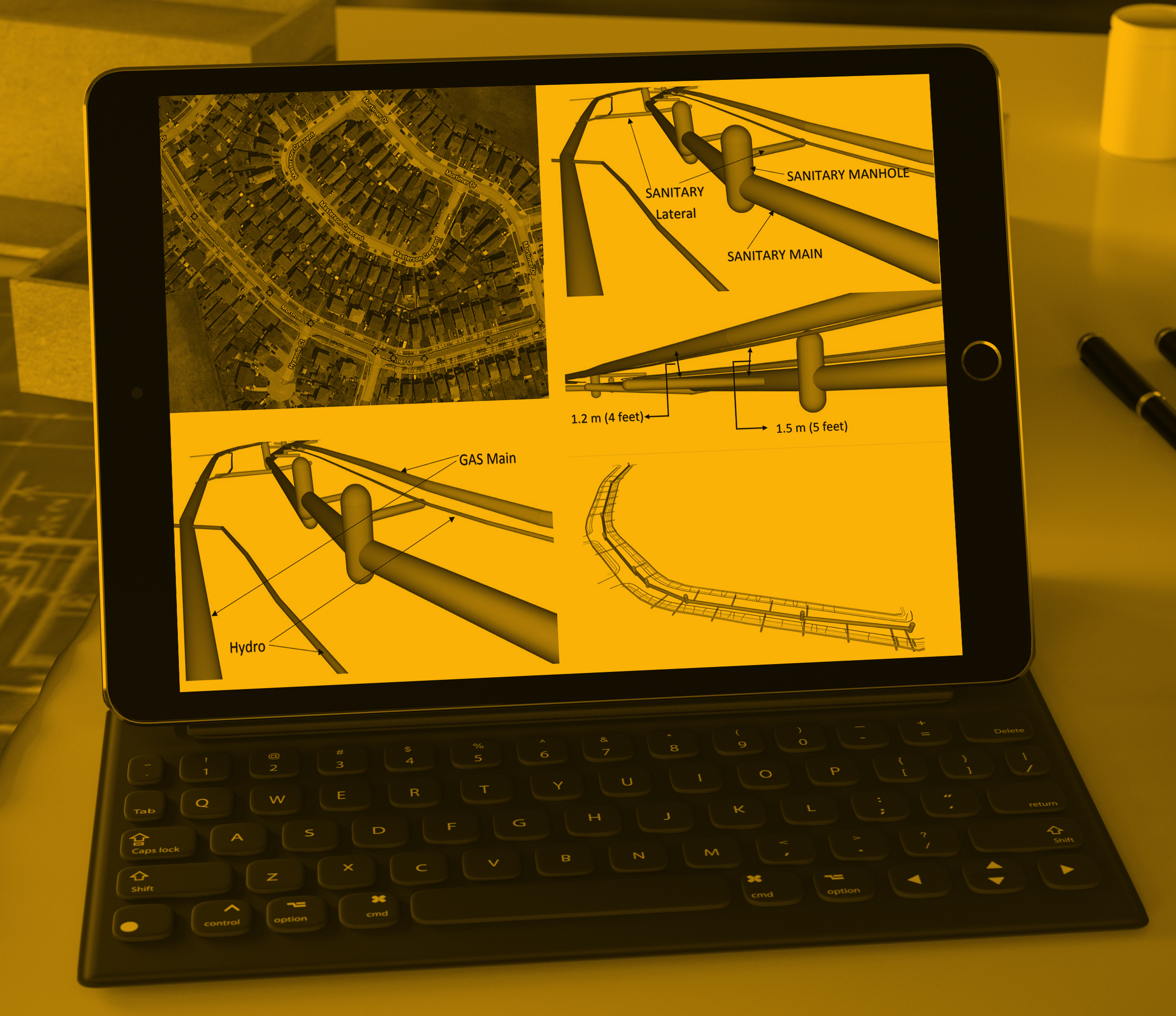
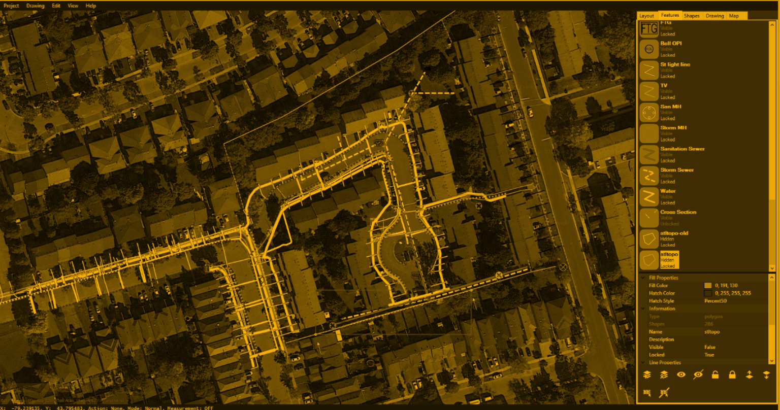
ID Technologies has created a comprehensive electronic drawing software for projects that involve mapping. Our software helps provide a visual representation of utilities and masses and their location within an excavation work area. These electronic versions of drawings are much clearer to read when compared to conventional hand-drawn sketches. All of the locate specific information is input directly from the program, and then transferred to output files. Our program also allows for direct emailing to clients, digital archiving, as-built map integrations, and many other features.

Mobile Asset Management Systems
Helping Users utilize GPS Technologies
Our wireless GPS systems assist users in GPS data acquisition, monitoring, managing and mapping. We have a variety of GPS capabilities and have created specific technologies to facilitate user specification. Our mapping suite allows users to acquire geospatial information with precision and allows them to further integrate collected information into a database. These GPS capabilities are vital when trying to map and manage assets once a project is completed. We have also facilitated GPS capabilities for users with fleets and other assets. Our systems can provide real-time monitoring of employees and fleets so users always know where their employees and mobile assets are.
